

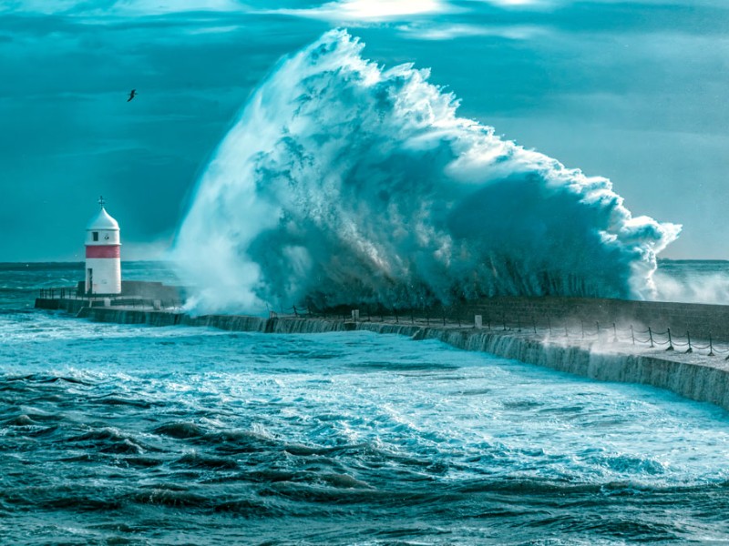
East or southeast winds could reach 55-65mph
A yellow weather warning has been issued by Ronaldsway Met Office for severe gales and rain.
It's as winds are to increase in the Isle of Man overnight into Tuesday (27 January) and peak before dawn, then easing late morning.
East or southeast winds will mean 40-45mph with gusts widely 55-65mph.
As a result of the inclement weather, this afternoon's Manxman sailings and all of tomorrow's have been cancelled.
Forecasters say it's due to a 'rapidly deepening area of low pressure to the south of Ireland' due to Storm Chandra.
An area of patchy rain arriving this afternoon (Monday 26 January) 'will become persistent and sometimes heavy on Tuesday morning with rainfall accumulations of 10-20mm widely with 20-40mm over high ground'.
'This may lead to surface water flooding in prone locations'.
'Between 3am and 9am the rain may turn to sleet or snow over high ground'.
This may lead to disruption on the likes of the Mountain Road.
We're told there is the possibility of minor coastal overtopping along exposed coasts and promenades around the time of high tide (5am), and to expect disruption to travel as well as a risk of some damage due to fallen trees due to the gale force winds.
The warning will be in place from 3am tomorrow morning until midday.
 NSC pool 'remains busy' despite ongoing tile issue
 Hundreds attend Isle of Man Graduate Fair
 No change to diesel prices says EVF after latest shipment
 'No guarantee there'll be any support' amid ongoing fuel crisis